Click here to read all Adventure-related posts
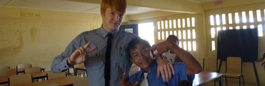
At the end of our service as teachers, volunteers in Guyana get roughly five weeks of holiday before we fly back to the UK. Some choose to stay in their projects, some explore more of Guyana, and some decide to travel further afield. Harry and I have decided we’re going to go on an adventure around the top chunk of South America, focussing mainly on Bolivia and Brazil.
We have been planning this for quite some time, and because of my OCD-tendancies we have an itinerary that includes a frankly sickening level of detail. For the interested parties, below is a rough outline of our planned adventure. (Scroll down to skip the wordy bit and look at the cool map)
School ends on Friday the 5th of July. We travel via Lethem and Bonfim (now entering Brazil) to Boa Vista, from where we catch a bus to Manaus on Sunday evening. We arrive in Manaus on Monday, and then on Tuesday catch a 5-day boat upstream to reach Porto Velho. We bus to a place I simply cannot pronounce, cross the border (now entering Bolivia), then get a second bus to La Paz.
We have 5 days in La Paz, 1 of which will be spent mountain biking along the World’s Most Dangerous Road (the one from Top Gear, a.k.a. “Death Road” or “The Devil’s Highway”). After La Paz we head north to spend 3 days in Copacabana (the Bolivian one), checking out Lake Titicaca and Isla del Sol. From there we travel south again, through La Paz, down to Uyuni, where we will spend 3 days touring Salar de Uyuni (the massive salt flats). We travel back to La Paz overnight, from where we catch a flight to Rio de Janeiro.
The flight stops off along the way at Santa Cruz, Asuncion (now entering Paraguay), Buenos Aires (now entering Argentina) and Sao Paulo (now entering Brazil, again). Each stop is between a few hours to a whole day, so we’re hoping to leave a few airports and have a look around (and maybe get some passport stamps if we can!).
Once we land in Rio de Janeiro, we have 6 days to explore, adventure and relax – we plan to visit Cristo Redentor (the huge statue of Christ the Redeemer), Escadarai de Selaro and Ipanema beach, as well as whatever else we find to do whilst we’re there.
From Rio de Janeiro we fly back to Boa Vista (via Sao Paulo and Manaus) where we catch a bus back to Bonfim, and from there travel back to Lethem (now entering Guyana). From Lethem we travel back up to Georgetown (either by bus or by plane – it depends what the Department of Education is providing for us), spend one last day there, and then fly back to the UK to see our families again (after stopping off for a day in Barbados, of course).
If all of that was a bit too much to take in, here’s a much simpler, much prettier verison:
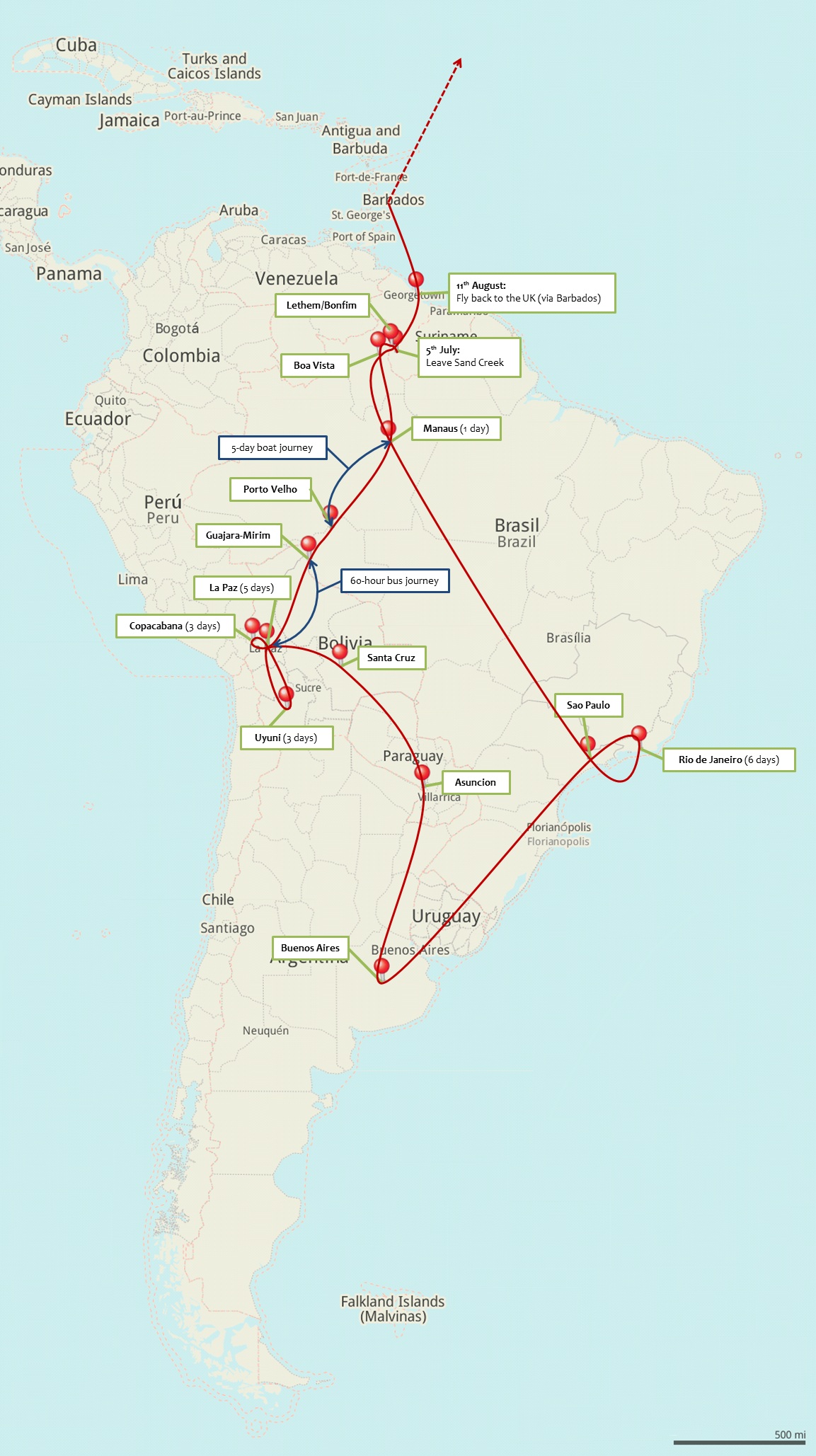
(Believe it not, this map was made in MS Word!)
Personally, I think our plans sound fantastic, and I can’t wait to get started. A lot of the places we’re stopping at have Internet access (either through cafes or hostels with free WiFi), so I should hopefully be keeping up with the blog and letting you know where I am and what I’m up to. Even if I don’t manage to keep the blog current, I’ll be writing posts wherever I am and uploading them when I get home. I’ll also be updating my profile of visited places on Wolpy, which you can see here: www.wolpy.com/markormesher
As ever, thank you for reading, and watch this space!

One Comment on “The Adventure” (+ Cool Map)
2 Pingbacks on “The Adventure” (+ Cool Map)
Pingback: TG#33 – Sleep in a Tree AND TG#38 – Walk to a Project | Mark's Project Trust
Pingback: Here We Go! | Mark's Project Trust